
Origin :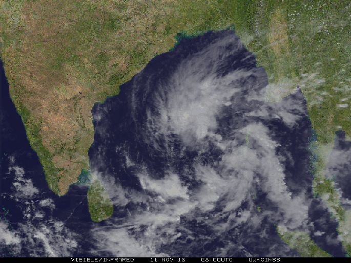
- The depression over SE Bay Of Bengal (BoB) intensified into a deep depression (DD) in the evening of 10th November 2018 over SE & adjoining central BoB.
- The DD intensified into a Cyclonic Storm (CS) “GAJA” while moving further West-NorthWestwards over East-central and adjoining west-central & southeast BoB on the early morning of 11th November 2018.
- The cyclone lay 840 km east of Chennai and 880 km east of Nagapattinam. It is likely to intensify into a severe storm in the next 24 hours, an IMD bulletin issued at 4p.m. said.
Propagation :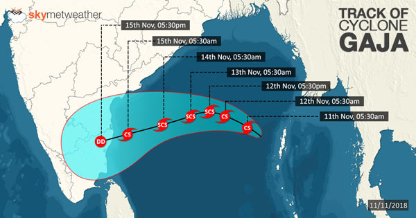
- It is expected to move west-northwestwards during the next 36 hours and then west-southwestwards towards the north Tamil Nadu–south Andhra Pradesh coasts in the subsequent 48 hours.
- While moving west-southwest, it is likely to weaken gradually and cross the north Tamil Nadu–south Andhra Pradesh coasts between Cuddalore and Sriharikota during 15th Nov. forenoon.
Dissipation and Effects :
- During the course of propagation of the severe cyclone over the land, it will gradually weaken, shedding heavy amount of rainfall over the region.
- On November 15, the rainfall intensity will increase gradually at most places and it will be heavy to very heavy at a few places and extremely heavy (above 20 cm) at isolated places over north Tamil Nadu.
- Squally wind speed reaching 45-55 kmph, gusting to 65 kmph is likely to commence along and off north Tamil Nadu–south Andhra Pradesh coasts from November 14 morning.
- It is likely to increase gradually, with wind speed at 80-90 kmph off north Tamil Nadu–south Andhra Pradesh coasts over west central & adjoining southwest BoB from midnight onwards.
– Anish Mahanta
( )
